Project Information
| Client: | Strathbogie Shire Council |
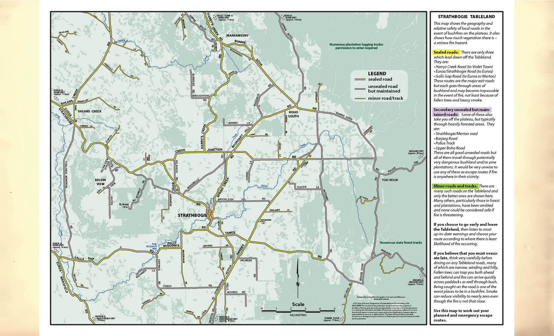
| Project: | Strathbogie Tableland Map |
| Purpose: | Map shows the geography and relative safety of local roads in the event of bushfires on the plateau. |
| Size: | A3 |
| Product: | Acrobat files for printing |
.
.
.
.
.
.
.
.
.
.
.
.
.
.
.
..
.
.
.
.
.
.
.
.
.
.
.
.
.
.
.