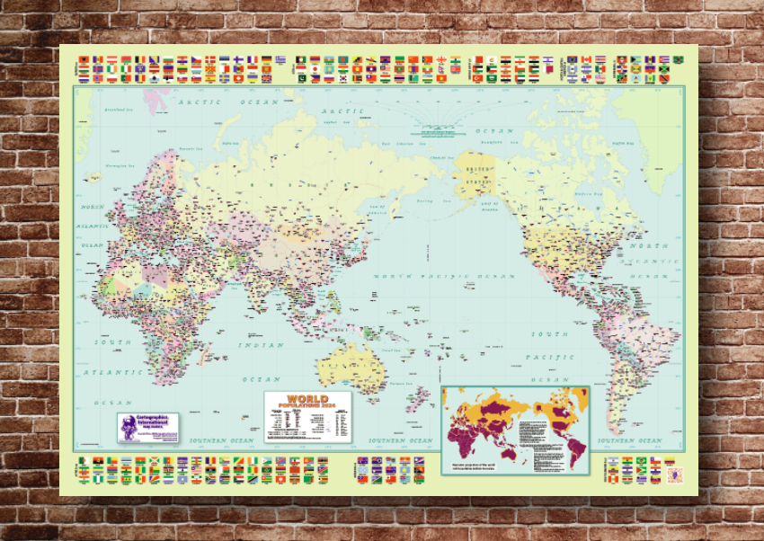
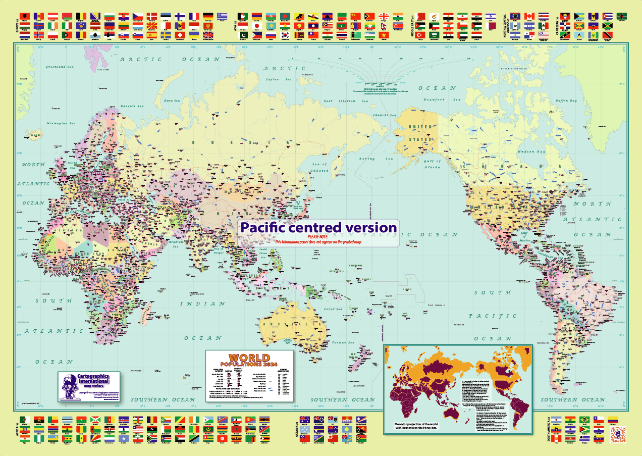
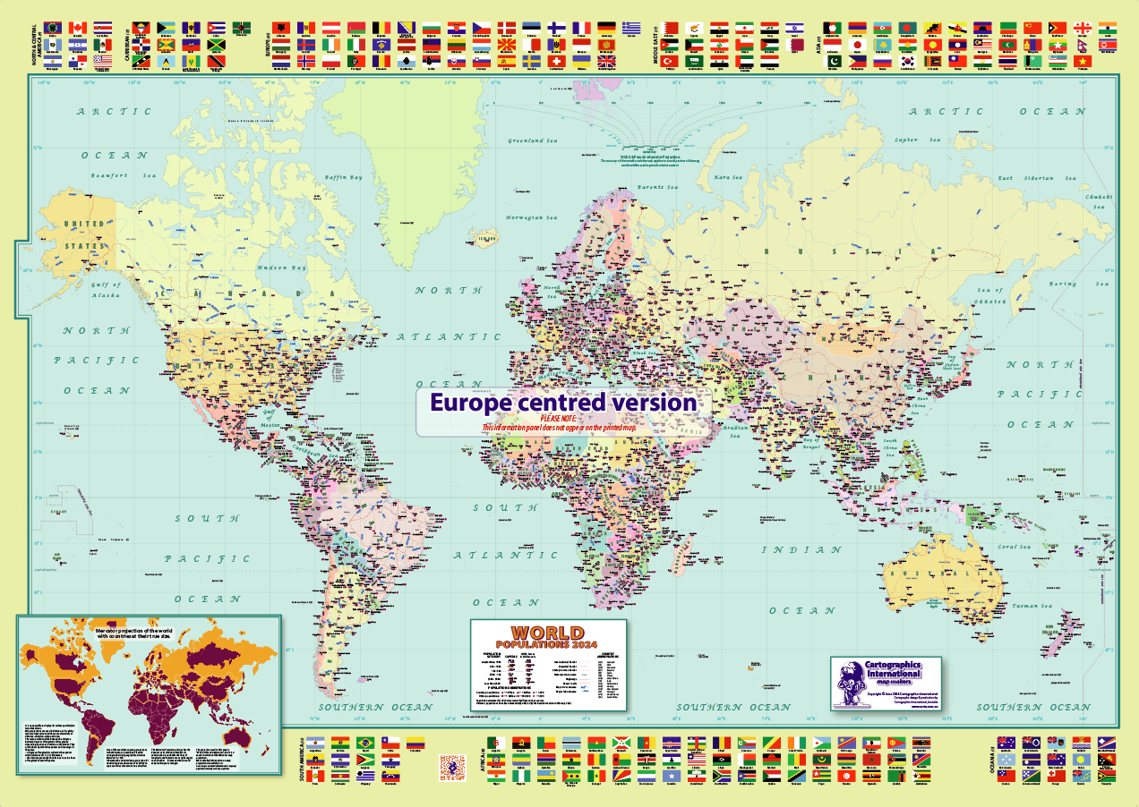
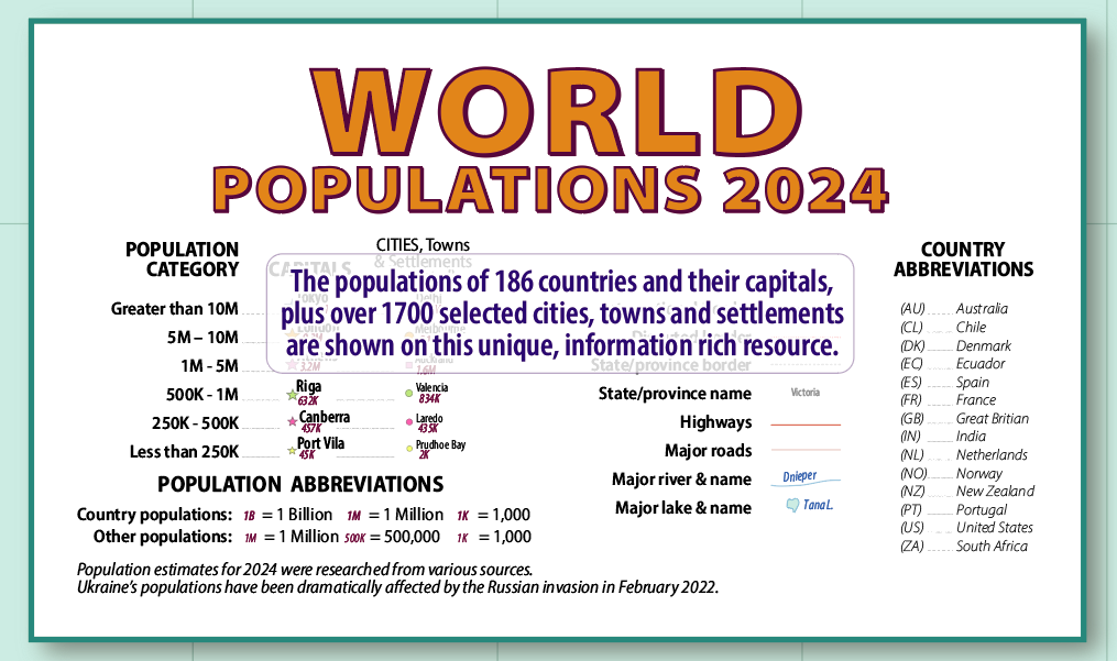


Map features:
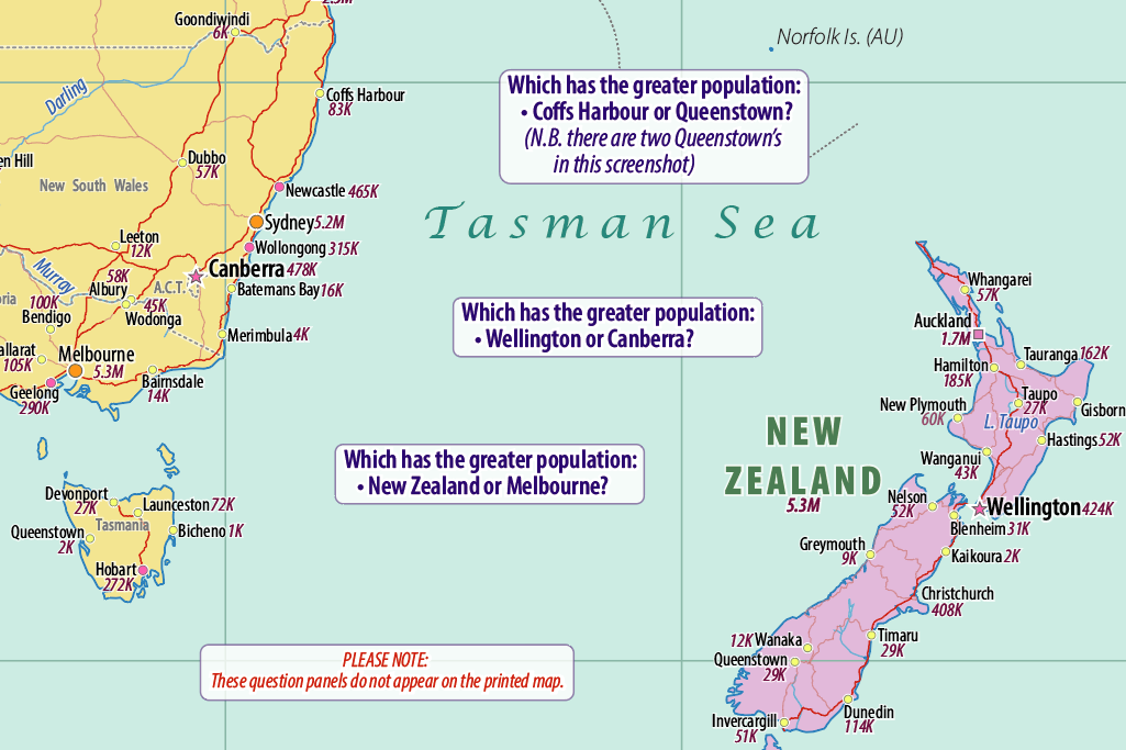
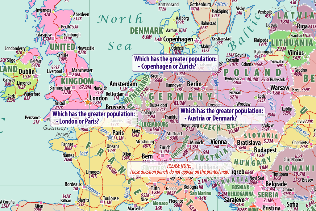
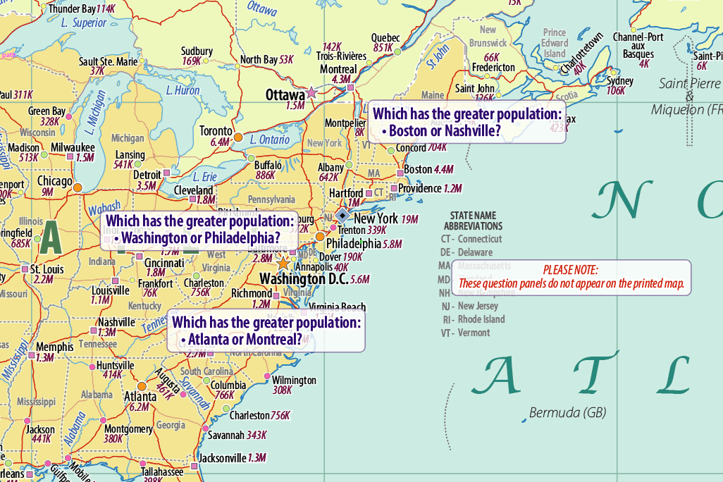
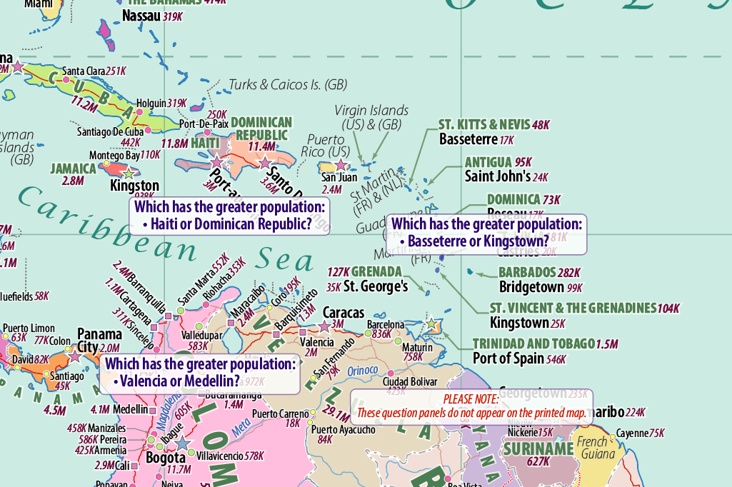
- Populations of 186 countries and capitals, plus selected 1742 cities, towns and settlements.
- Countries plus Australian, US and Brazilian States and Canadian Provinces.
- Country flags are grouped by geographic area.
- Major rivers, lakes, highways and main roads, minor islands and more.
- Unique inset map showing true country sizes.
The map is:
- Poster size – 1092 x 772 mm (43 x 30 inches approx.)
- A high-quality off-set poster print on 170 gsm (45 lb.) bright-white paper.
- Up to date in terms of geographic and population data.
- Expertly designed, with judicious typography and type placement for maximum legibility
- Easy on the eyes with a pleasing, bright colour palette
- Perfect for laminating and framing.
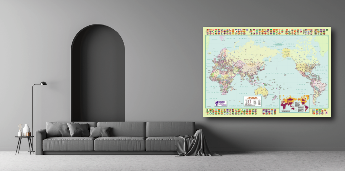
- An ideal map to hang in a home, library, study, executive office, lobby or classroom.
- Educational and ideal for kids, students, and curious adults.
- A great gift.
- Shipped rolled in a tube (NOT FOLDED!).
Jason Hulme –
Have this on my wall! Very happy with it.
Kate and Ross –
We love our World Populations 2024 Map — the perfect blend of detail and discovery. Loads of interesting facts and a thing of beauty that brings the world to life!
Ian McKenzie –
Great innovative presentation of a complex topic. Love the explanation of Mercator effect as an added bonus.